
Finding Sunnyvale Streets by Address
The Sunnyvale street directory begins with a property location, not an assumed person list. Enter the situs address in the Santa Clara County Assessor’s Real Property Search. Record the APN, latest transfer document number, transfer date, and city or tax-rate jurisdictions. Then use Sunnyvale GIS or the County parcel map to see the target lot and its immediate neighbors. The map helps define the parcel set; it is not the official assessment roll.
The next steps move from location to evidence. The Assessor result omits the assessee name on the public web result. The Recorder has no street-address index, so its deed search needs an APN, document number, party name, date, or book and page. A voter record is a regulated self-check or approved-purpose file, not a public street roster. Historical occupants belong in reverse directories, ordinary city directories, census schedules, newspapers, and yearbooks.
- Search the situs address in Real Property Search and copy the APN and newest transfer document number.
- Open the parcel in the County dataset or Sunnyvale GIS, pan and click the lots around it, and write down their APNs.
- Carry each APN or transfer number to the Clerk-Recorder workstation, using Digital Reel for 1850 through 1980 and workstations for 1981 forward.
- Read the deed for grantor, grantee, recording date, legal description, and any return address, then search an earlier seller as a prior grantee.
- Add permits, voter rules, or a library reverse directory only for the question and time period they can support.
This street-by-street order makes the address a reliable anchor while leaving room for uncertainty about occupancy.
Sunnyvale Street Directory Search Fields
The Assessor form has three useful modes: a simple property address search, an advanced address search, and an APN search. The form asks for where the property resides, not an owner’s mailing address. Accept the terms before running the search. City selection matters when a street name appears in more than one place.
| Field | Type, requirement, or limit |
|---|---|
| Property address | Text or autocomplete; required in simple mode and tied to the situs. |
| Terms and conditions | Required checkbox before Search. |
| Street number | Text or number in advanced mode. |
| Street direction | Optional dropdown; use the direction printed in the official address. |
| Street name and type | Street name is required; type is an optional dropdown. |
| Unit | Optional condominium or unit qualifier. |
| City | Required in advanced mode; choose Sunnyvale for a Sunnyvale situs. |
| APN number | Required in APN mode; dashes may be included or omitted. |
A result can return the APN, title-transfer document number and type, transfer date, assessed land and improvement values, exemptions, net assessed value, and several tax-rate jurisdictions. It does not return a public owner-name or mailing-address result. That omission is central to the local street directory workflow.
Sunnyvale’s Missing Assessor Name
The California-specific quirk is easy to miss: the public property result is rich in parcel facts but intentionally silent on the assessee name. California Government Code section 7928.205, formerly section 6254.21, is part of the reason the web output cannot be treated as an owner-name roll. The latest transfer document number is still visible, which makes the result a bridge to the Recorder.
The Santa Clara Assessor search image below shows the type of address-keyed interface used in a Sunnyvale street directory search. Use it to learn the fields, not to promise a result the form does not publish.
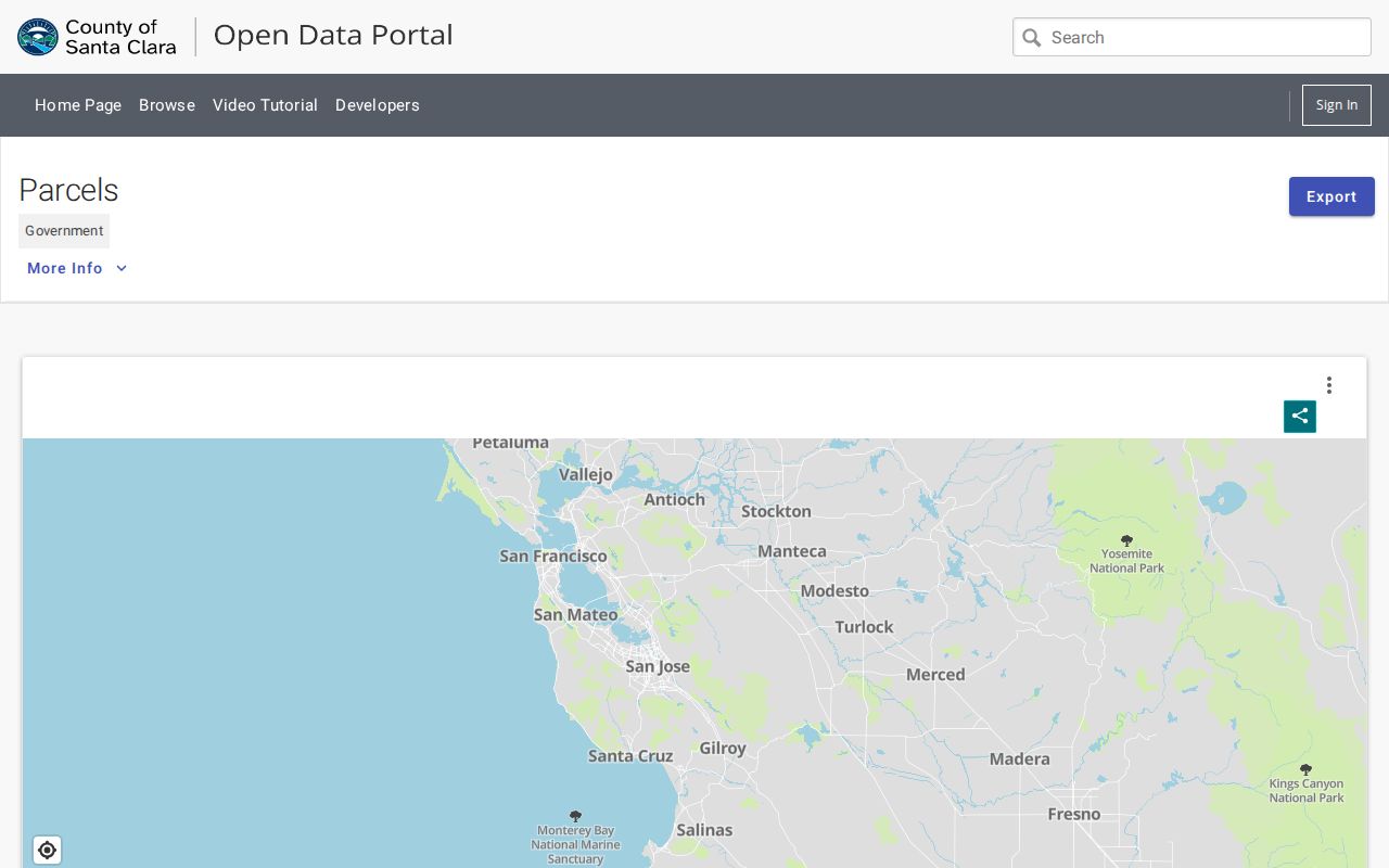
The parcel map and property result help select the next official record. They do not turn a street into a list of household members.
Walk Sunnyvale Parcels in GIS
Sunnyvale’s GIS directory accepts a geographic location by address, APN, street intersection, or landmark. The County open-data parcel resource offers a map view, summary-table view, export control, and metadata. Viewers can expose parcel polygons, APNs, land-use and district layers, along with zoning, flood, development-project, transit, utility, park, council-district, and neighborhood-association information depending on the selected map.
To walk a short block, search the target address, zoom until lot lines are clear, click the target parcel, and copy the APN. Click the immediately adjoining polygons and repeat. If the goal is a whole named street, switch to the full street directory workflow instead of treating every visible lot as a neighbor or household.
| GIS control | Use in an address search |
|---|---|
| Address | Find the geographic location of the target parcel. |
| APN | Open a known parcel identifier. |
| Intersection or landmark | Start a block browse when a full address is not known. |
| Pan, zoom, and click | Define the adjacent parcel set and inspect available attributes. |
| Map, table, export, More Info | Change view or retrieve dataset details; exported GIS is not authoritative. |
The County warns that dynamic GIS can differ from primary source data. Confirm each important APN with the Assessor and each title claim with the Recorder.
Sunnyvale Street Directory Records by Address
Several records can be keyed to a Sunnyvale street, but each describes a different relationship. This coverage table keeps the sources from blending into one claim about who lives there.
| Record set | Keeper | Address result | Access |
|---|---|---|---|
| Assessor property search | Santa Clara Assessor | APN, transfer number, values, exemptions, jurisdictions | Free web result; owner name omitted |
| Parcel map and GIS | County and Sunnyvale GIS | Parcel shapes, APNs, land-use and district layers | Free viewers; confirm with primary records |
| Deeds and liens | Clerk-Recorder | Title parties, legal description, recording trail | Office index and image access |
| E-OneStop permits | City of Sunnyvale | Project address, plan history, applicant or contractor fields where public | Online, kiosk, counter, or request |
| Reverse directory | Library or collection keeper | Historical occupant entry by street number | Collection years and in-person rules apply |
The phrase used here is useful only when the record type stays clear. A deed proves title parties. A permit proves a project connection. A reverse directory shows what a publisher collected in a past year. None is a complete current resident list.
Carry the Sunnyvale Transfer Number Offline
The Assessor’s latest transfer document number is the strongest insider key in a Sunnyvale address search. At the Recorder, public workstations can search by document number, document date, document class, APN, grantor, grantee, or a combined grantor and grantee name. Older records may need a year plus a party or a book and page reference. The office does not search an address as a substitute.
Open the deed and record the grantor, grantee, recording date, legal description, prior references, and return or mailing block. Then search the seller as a grantee in an earlier period. Compare the legal description and APN before treating a repeated name as the same owner. The Recorder’s official-record index includes party name, role, document number, recording date, and document type.
Practical tip. Arrive early at 110 W. Tasman Drive. Busy workstation sessions may be limited to one hour, and a mail copy request needs an instrument number or book and page.
Records run from 1850 forward. Digital Reel covers 1850 through 1980; public workstations cover 1981 forward. Copies can be plain or certified. The Recorder’s purchasing instructions explain the identifiers needed for an order, while the current County fee schedule should be checked for copy and certificate charges.
The Assessor’s published annual report is useful for office context and roll statistics, but it does not replace the address search or deed image.
Sunnyvale Permit History Limits
E-OneStop lets the public search permit and plan history by property, while City Hall provides computer kiosks, staff help, and a Permit Center counter. A building or fire application can carry the project address, applicant or agent information, work type, description, permittee, contractor, property-owner identity, and related planning, fire, or Neighborhood Preservation case number when those fields are public.
Those fields show a project connection. An applicant may be an agent. A contractor may work at many properties. A property owner may not be the person who occupies the parcel. Keep permits beside the APN and deed, rather than using a permit name as the answer to a resident lookup.
Planning, Engineering, and Building service is generally offered weekdays from 8 a.m. to noon and 1 to 5 p.m., with service-specific schedules. The city’s public-record page is the fallback for an identifiable existing file. Under the California Public Records Act, a request should name the department, record type, address or case number, and date range. The City need not compile a new street directory.
Situs, Mailing, and Legal Address Terms
Address words are not interchangeable. The situs is where the property sits. A mailing address is where a notice or return document may be sent. A legal description identifies land by lot, block, subdivision, or another parcel description. A plat is a recorded map that can show how lots and streets were laid out. In an address search, these keys help bridge a changed street label or postal notation.
- Parcel
- A mapped unit of land with an APN assigned for assessment and related records.
- Situs address
- The physical location used by the Assessor’s address search.
- Legal description
- The deed language that identifies the land apart from a postal label.
- Plat
- A recorded map of lots, blocks, streets, or subdivisions.
- Criss-cross directory
- A historical directory arranged by address or street rather than only by surname.
Sunnyvale research has no verified citywide street-renumbering year. If a label appears to drift, compare the APN, legal description, subdivision map, city-limit layer, and directory year. Do not invent a renumbering event to explain a gap.
Old Sunnyvale Streets in Reverse Directories
Reverse or criss-cross volumes put old Sunnyvale streets in number order. SJPL reports Haines and Pacific Bell reverse directories from the mid-1960s, with broader holdings and gaps. A 1964 and 1968 R.L. Polk sample shows how a street entry can mix business use, apartments, abbreviated names, multiple residents, vacancy marks, and “Street continued.” One 1968 South Murphy Avenue entry lists an apartment name followed by several abbreviated resident entries.
Read a reverse volume beside its alphabetical companion. The address page can show who the publisher placed at a number, while the name page can reveal an occupation or a cross-reference. Compare 1964, 1966, and 1968 when available. A missing name may mean a missing volume, a publisher omission, changed city limits, a changed number, vacancy, or no response. It is not proof that no one lived there.
The historical shelf belongs to the Sunnyvale directory book page. The current street directory uses it only as a past-occupancy layer.
Sunnyvale Voter Status Limits
My Voter Status can return a matching voter’s own registration and election information after identity fields are entered. It cannot be used to type a Sunnyvale street and download every registered voter there. A separate voter-file request is limited to approved election, scholarly, journalistic, political, or government purposes. Commercial use is forbidden, protected voters are excluded, and address, contact, identification, and signature fields are confidential except through authorized access.
A lawful records researcher can use the public self-check for their own status or contact the Registrar of Voters about the regulated application. The statewide file can carry precinct, district, status, registration date, party preference, vote-by-mail status, and participation method. It never reveals ballot choices. That boundary is why a street directory should not promise a block roster.
What a Sunnyvale Street Directory Cannot Show
A Sunnyvale street directory can connect parcels, title records, project files, and selected historical listings. It cannot reliably show every child, roommate, guest, household member, or non-owner occupant. DMV addresses are protected by the federal Driver’s Privacy Protection Act. Utility customer accounts, delivery records, and protected substitute addresses are not public street lists.
Lawful use. Address records are appropriate for personal history, parcel research, civic curiosity, and personal safety awareness. Using a street search to follow, threaten, harass, or intimidate someone can violate California law and is prohibited.
When the goal shifts from a whole street to one person, use the Sunnyvale resident lookup workflow and match at least two non-circular sources. A block question needs adjacent parcels and community contacts, with the same privacy limits.